Clark Point
Clark Point on the coast in Delaware. Coastal and sea fishing with species ranked by weather, water temperature and season, see below.
Conditions right now
Weather
🌤️ Mainly clear
Water temp (est.)
23.7°C
Air temp
26.8°C
Wind
5.2 m/s
Pressure
1011.0
↓ falling
Clouds
27.0%
Water temperature is an estimate based on weather and season.
Best times today
🌅
Dawn
04:50–06:50
🌇
Dusk
19:12–21:12
Local time at the spot, from the most likely species' daily rhythm.
Next hours
09:00
🌤️
27.0°
10:00
☀️
29.0°
11:00
☀️
31.0°
12:00
⛅
32.0°
13:00
🌤️
33.0°
14:00
⛅
34.0°
15:00
🌦️
34.0°
16:00
☁️
34.0°
17:00
⛅
34.0°
18:00
⛅
34.0°
19:00
⛅
33.0°
20:00
⛅
30.0°
Likely catch now (5 species)
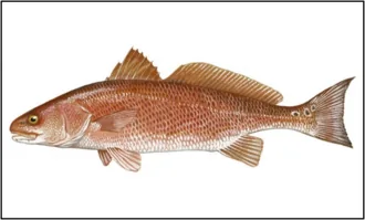
Red Drum
Sciaenops ocellatus
Slow during the night, water near its preferred 24 degrees, falling pressure ahead of weather.
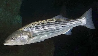
Striped Bass
Morone saxatilis
Slow during the night, water near its preferred 24 degrees, bright sky slows things.
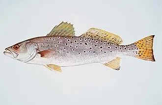
Spotted Seatrout
Cynoscion nebulosus
Slow during the night, water near its preferred 24 degrees, falling pressure ahead of weather.
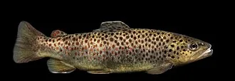
Brown Trout
Salmo trutta
Slow during the night, peak season, bright sky slows things.
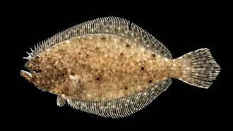
Summer Flounder
Paralichthys dentatus
Slow during the night, water near its preferred 24 degrees, peak season.
Tips right now
Technique
Start with a soft-plastic jig for red drum, the most likely catch right now.
Lure
Soft-plastic jig for red drum: Soft-plastic on the flats.
Timing
Red drum is slow at night. The best bite comes at dawn.
Colour
Clear water and good light: try gold, natural and white for red drum.
Depth
The water temperature suits the fish. Fish actively at normal depths and edges.
Fishing permit
A state fishing license is required to fish here. Licenses are issued by each state:
About this water
Clark Point is an ice-covered headland at the east side of the entrance to Paulding Bay. It was delineated by G.D. Blodgett (1955) from aerial photographs taken by U.S. Navy Operation Highjump (1946–47), and named by the Advisory Committee on Antarctic Names for George W. Clark, Midshipman on the sloop Peacock during the United States Exploring Expedition (1838–42) under Lieutenant Charles Wilkes.
Read more on Wikipedia →