Beacon
Beacon on the coast in New York. Coastal and sea fishing with species ranked by weather, water temperature and season, see below.
Conditions right now
Weather
⛅ Partly cloudy
Water temp (est.)
23.1°C
Air temp
27.0°C
Wind
2.5 m/s
Pressure
1008.0
→ stable
Clouds
52.0%
Water temperature is an estimate based on weather and season.
Best times today
🌅
Dawn
04:37–06:37
☀️
Day
06:37–19:15
🌇
Dusk
19:15–21:15
Local time at the spot, from the most likely species' daily rhythm.
Next hours
09:00
⛅
27.0°
10:00
⛅
29.0°
11:00
☁️
31.0°
12:00
⛅
32.0°
13:00
☁️
33.0°
14:00
🌧️
34.0°
15:00
☁️
27.0°
16:00
⛅
26.0°
17:00
🌦️
29.0°
18:00
🌦️
28.0°
19:00
☁️
26.0°
20:00
⛅
25.0°
Likely catch now (3 species)
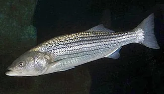
Striped Bass
Morone saxatilis
Slow during the night, water near its preferred 23 degrees, a fishy ripple on the water.
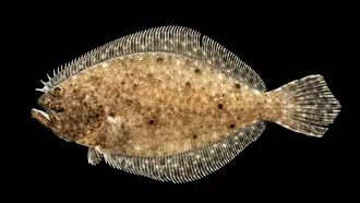
Summer Flounder
Paralichthys dentatus
Slow during the night, water near its preferred 23 degrees, peak season.
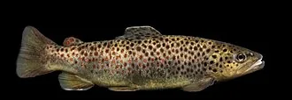
Brown Trout
Salmo trutta
Slow during the night, peak season.
Tips right now
Technique
Start with a crankbait for striped bass, the most likely catch right now.
Lure
Crankbait for striped bass: Big swimbaits and plugs.
Timing
Striped bass is slow at night. The best bite comes at dawn.
Colour
Clear water and good light: try silver, white and natural baitfish for striped bass.
Depth
The water temperature suits the fish. Fish actively at normal depths and edges.
Fishing permit
A state fishing license is required to fish here. Licenses are issued by each state:
About this water
A beacon is an intentionally conspicuous device designed to attract attention to a specific location. A common example is the lighthouse, which draws attention to a fixed point that can be used to navigate around obstacles or into port. More modern examples include a variety of radio beacons that can be read on radio direction finders in all weather, and radar transponders that appear on radar displays.
Read more on Wikipedia →